The best anchorages when sailing around the beautiful islands of the Dalmatia region in Croatia.
Thanks to the very indented coastline, in Dalmatia region and its islands are numerous, pleasant, and secluded anchorages. After enjoyable sailing during the day, drop off the anchor and indulge yourself in unspoiled nature and crystal clear Adriatic sea.
In most bays, anchoring is allowed; furthermore, it is free of charge. However, you might be charged for the anchorage only if you anchor within the area for which commercial organization has concession issued by the Croatian Authorities.
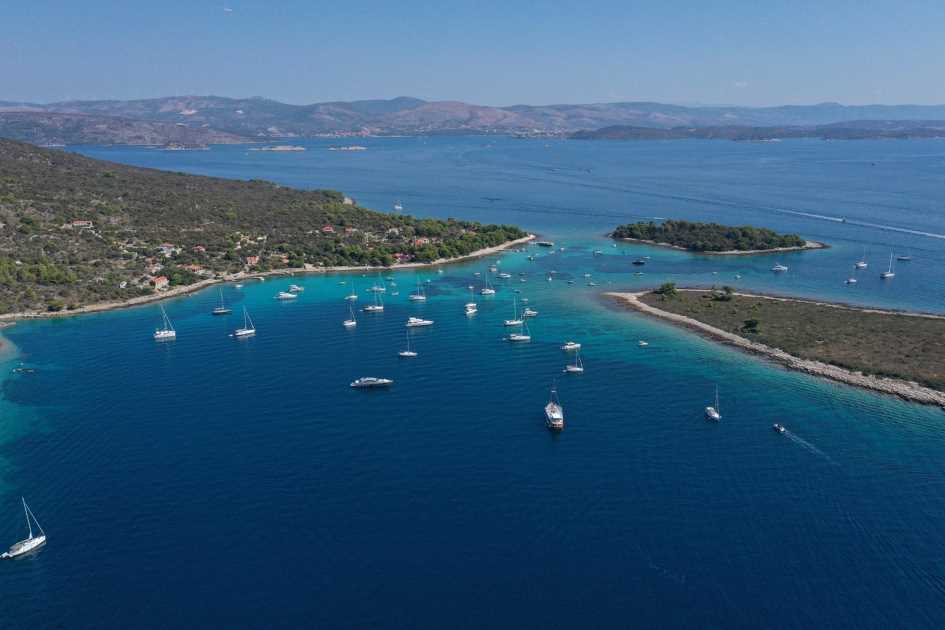
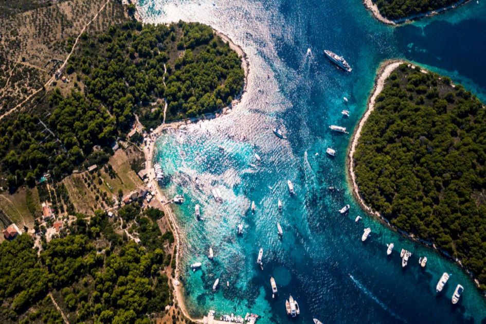
BLUE LAGOON – KRKNJAŠI, Middle Dalmatia
Coordinates: 43°26’24.1″N 16°10’27.6″E
Seabed: rocks and sand
Wind Protection: it is protected from W, NW, W, NE
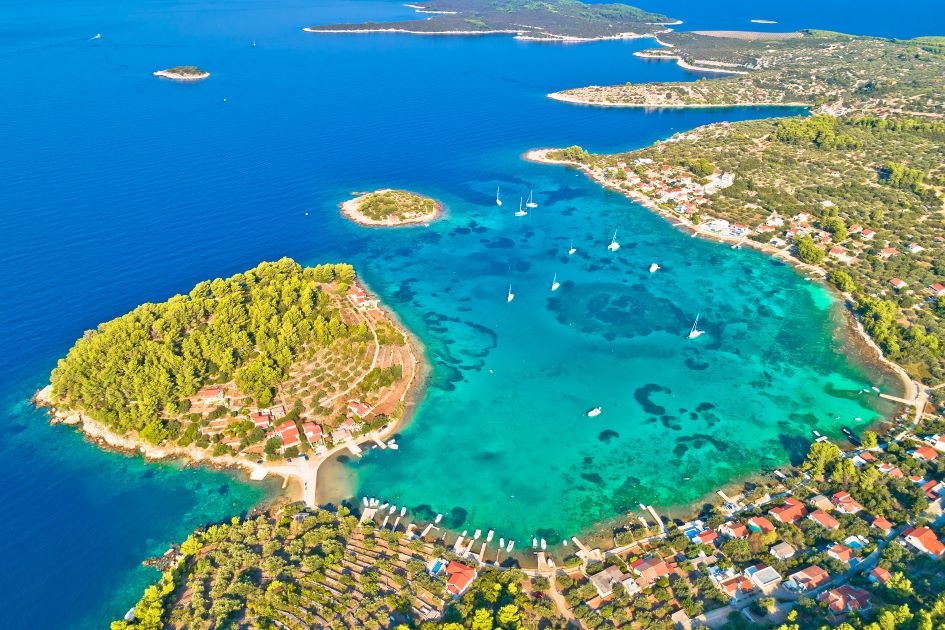
Sailing 8NM southwest from Trogir, you will find the most popular beach and anchorage in the area. By the small two islands, Krknjaši and Drvenik Veliki is well known as the Blue Lagoon anchorage. This anchorage is very popular because of its crystal clear turquoise water. The place is pretty crowded during the day, as many visitors from Split and Trogir get there with smaller speed boats, but in the later afternoon, when they leave, it`s quite all of a sudden. Onshore of Drvenik Veliki are two restaurants.
Blue Lagoon is an ideal anchorage to spend a day; however, if you decide to stay overnight, make sure that the weather conditions are favorable.
STARI TROGIR – Middle Dalmatia
Coordinates: 43°29’19.8″N 16°02’33.3″E
Seabed: sand.
Wind protection: all winds except E and SE
On 11 NM sailing from Trogir and 5 NM sailing from Rogoznica is a beautiful and full bay with sandy beaches and shallow water. Anchorage is well protected from all winds except for East and South East. In Stari Trogir Bay, you can enjoy swimming and snorkeling in a crystal clear, turquoise sea. If you are sailing with kids, they will love it.
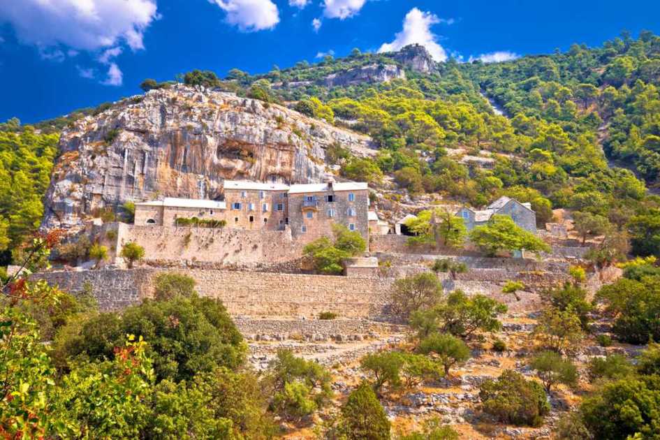
BLACA – ISLAND BRAČ, Middle Dalmatia
Coordinates: 43°16’38.3″N 16°30’57.9″E
Seabed: rocks and sand
Wind protection: from all winds except the S
Blaca is a lovely bay and anchorage on the south coast of the island of Brač. Tranquil and uncrowded bay with a sandy bottom. You can anchor with a long line ashore.
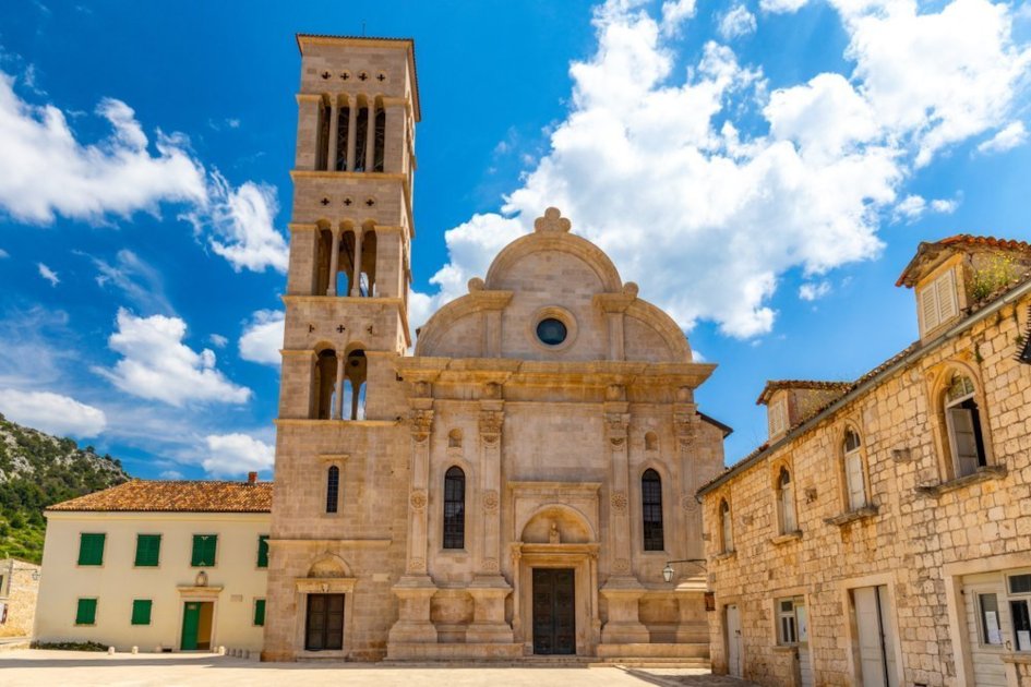
Thirty minutes walking from the bay is the well-known Blaca Monastery and hermitage from the 16th century. The monastery was home to monks from the mainland who found shelter in this naturally protected place, Blaca monastery will astonish you. It was the naval, trading, and observatory center of this part of Dalmatia. Blaca is considered a desert because of the scarce nature which surrounds the complex.
NEDOMIŠALJ – ISLAND HVAR, Middle Dalmatia
Coordinates: 43°16’38.3″N 16°30’57.9″E
Seabed: rocks and sand
Wind protection: from all winds except the W
Nedomišalj anchorage is located on the northern side of the island of Hvar, near Starigrad. It is well protected from all winds except against the West.
GRAČIŠĆE – ISLAND HVAR, Middle Dalmatia
Coordinates: 43°11’60.0″N 16°31’41.8″E
Seabed: rocks and sand
Wind protection: from all winds except N and NE
Gračišće cove is located on the southern side of the Stari Grad nautical treasure. It is a small and intimate cove with beautiful pebble beaches and a small dock approachable with a dinghy.
You can spend a day on the beach in the shade of a thick pine forest with the sounds of crickets in the background. Most of the coves on the southern side are shaded in the afternoon, making them suitable for people who do not like spending too much time sunbathing.
PARJA Bay – ISLAND HVAR, Middle Dalmatia
Coordinates: 43°11’31.0″N 16°23’52.1″E
Seabed: rocks and sand.
Wind protection: from all winds except N
Parja anchorage is located on the northern coast of the island of Hvar. Thick pine forest, crystal clear sea, and the silent surrounding will offer you a perfectly spent long summer day.
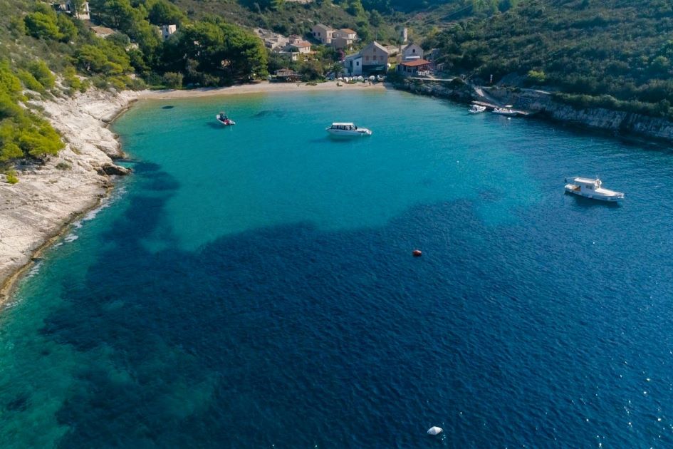
SALBUNARA – ISLAND BIŠEVO , Middle Dalmatia
Coordinates: 42°59’10.6″N 16°00’11.0″E
BIŠEVSKA LUKA (PORAT) – ISLAND BIŠEVO , Middle Dalmatia
Coordinates: 42°58’57.5″N 16°00’12.2″E
Seabed: sand
Wind protection: from all winds except W and SW, good protection from the Bura NE but very strong gusts are possible.
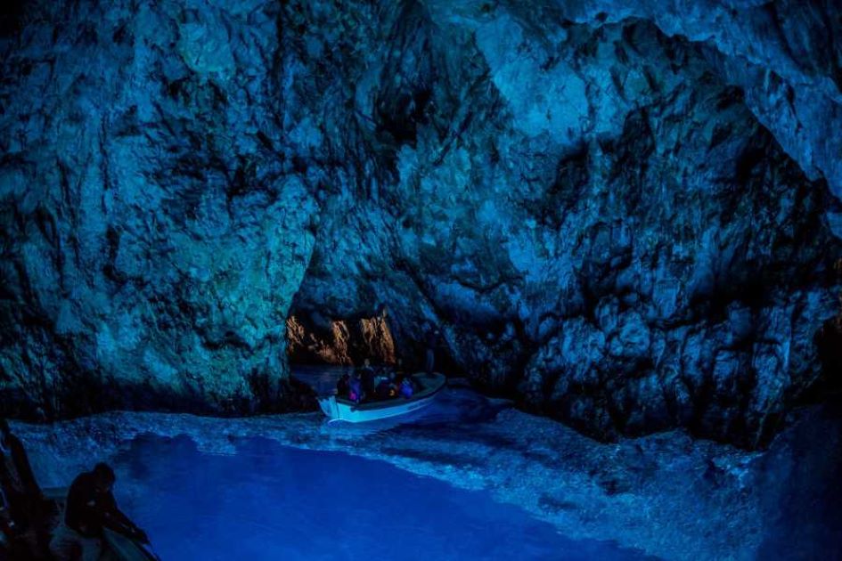
Salbunara and Biševska Luka are anchorages on the northwestern coast of the island of Biševo, 4 NM sailing southwest from Komiža ( Island Vis). Biševo is an island located in the center of the Dalmatian archipelago, with a population of 19 people. Untouched nature, crystal clear sea, uncrowded – a recipe for a completely relaxed sailing vacation. Due to its geographical position, the island of Biševo is mainly exposed to high waves and strong winds from the west, but also south and north. The calm sea is relatively rare. On the island of Biševo, there is no water supply network nor the drainage system, which is one of the main reasons for the continued depopulation. Most of the inhabitants moved to nearby Komiža and have remained attached to their island where they still have vineyards and olive groves and where they mainly reside during the summer.
Once visiting the island of Biševo, the unavoidable stop is the natural phenomenon Blue Cave ( Modra špilja) and Monk Seal Cave ( Medviđa špilja), both on the eastern side of the island.
In Biševska Luka, you can find two smaller restaurants (Konoba).
ROGAČIĆ – ISLAND VIS, Middle Dalmatia
Coordinates: 43°04’37.1″N 16°10’59.8″E
Seabed: sand, rocks
Wind protection: From all winds, except not quite well from the NE
On the northern coast of the island of Vis, west of the port of Vis deeply cut into the island is Rogačić port. Rogačić port is well protected from all winds and consists of two bays, the narrower and the longer one. On the west side is Parja bay. The other is Rogačić cove, which is slightly more open to the NE.
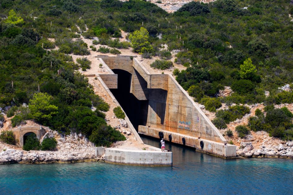
Opposite her, on the hill, the army built a tunnel that served as a shelter for the torpedo boat. In the tunnel, there is enough place to moor two sailing boats of 40`, and it is free of charge. The harbor is further protected by the northern winds by the islet Škojić. The bottom is muddy, sometimes covered with grass, and the depth varies from four to ten meters, reaching the middle of Parja cove.
From Rogačić you can walk 3 km to Vis port. On the hills above the neighboring bays, Vela and Mala Svitnja, there are English fortresses, St. George (Fortica), and half of the Bentich tower (Terjun).
GRADINA Anchorage – ISLAND KORČULA, South Dalmatia
Coordinates: 42°58’21.5″N 16°40’31.3″E
Seabed: sand
Wind protection: from all winds except W and SW
Gradina Anchorage is located on the northwestern side of the island of Korčula, on 4NM sailing from Vela Luka. Gradina Bay is under the port Authority of Vela Luka, equipped with 15 mooring buoys. If you decide to anchor in the bay, the Port Authority will charge you. The approximate daily anchoring fee is 100 Kn.
Even though Gradina is open to the W winds and Maestral, a small island inside the bay called “Gubeša” protects the bay partially from the W too. The water in the bay is very shallow, with mainly pebble beaches and with few sand spots. Gradina is a perfect destination for families with children. From your boat, you can enjoy the remarkable sunsets down the horizon of the open seas.
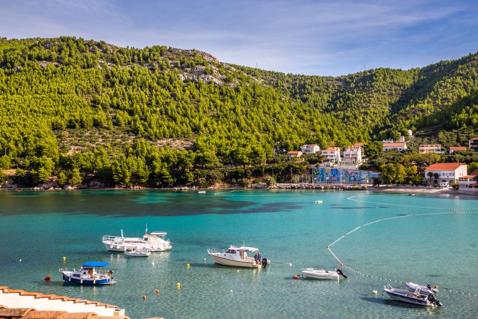
ŽULJANA – PENINSULA PELJEŠAC, South Dalmatia
Coordinates: 42°53’30.5″N 17°27’10.0″E
Seabed: sand
Wind protection: from all winds from N to SW, through W
Žuljana is a charming little village, located on the southwestern coast of the peninsula Pelješac, located approximately 50 NM from Dubrovnik. The bay is overlooking the island of Mljet and the Mljet channel. Approaching the bay by boat, you will be astounded by natural diversities. Fantastic scenery of hanging rocks and landscapes of lush pine woods stretching all along the seashore with amazing pebble beaches, underwater treasures, and friendly local people. The sea around Žuljana is ideal for snorkeling, diving, and spearfishing. Surroundings are suitable for walking, hiking, and biking.
Žuljana is unavoidable if you are sailing the south Dalmatia, or one way from Split to Dubrovnik or Dubrovnik to Split.
We recommend a visit to the nearby town of Ston, with impressive stone walls, ancient salt-works, and famous cuisine based on the shells naturally grown in Ston bay.
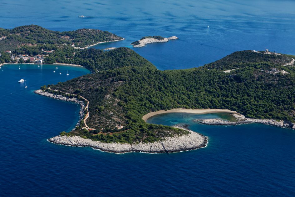
SAPLUNARA – ISLAND MLJET, South Dalmatia
Coordinates: 42°41’51.1″N 17°44’19.0″E
Seabed: sand
Wind protection: well protected from NE, quite ok from SE, but unprotected from S and SW
Saplunara Bay is situated on the SW side of Mljet Island. It is one of the most popular anchorages for those who sail in southern Dalmatia or the One-way sailing route from Split to Dubrovnik or the other way round. In the bay are available 15 mooring buoys. Saplunara is well known for its lovely beach and Blaca lagoon, just SE of Saplunara. In the bay, you can find a few restaurants and local markets.
The bay is recommendable for families on sailing holidays with children.
Regulations for Concessions on Maritime Domains and Seaports
In case you will be asked to pay the fee for the anchorage, this act is regulated by Law on Maritime Domain and Seaports of the Republic of Croatia.
The Concessionaire is obliged to issue an invoice to the person operating the vessel for the provided mooring service on the buoy or anchorage. If dry garbage has been taken over, the concessionaire is obliged to issue a certificate of taken garbage from the vessel. The service of picking up dry garbage from the vessel is included in the anchorage/mooring fee.
The person operating the ship, boat, and the yacht is obliged to keep an invoice and a certificate on the vessel until leaving the territorial sea of the Republic of Croatia. The concessionaire is obliged, upon the request of the boatman, to show the price list for the payment of the mooring fee certified by the County. The person operating the vessel at anchorage must take care that the vessel is sufficiently far from the nearest vessels in all directions and weather conditions.
Please note inside the area of National Parks, it is not allowed to anchor the boat. On the sea charts, which are the standard equipment of each boat, you can check the areas with anchoring restrictions. In this article, we mentioned only several anchorages in Dalmatia, but there are dozens more, which will delight you and offer a safe retreat.